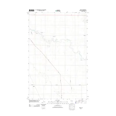
2013 Map of Hazel
USGS Topo · Published 2013About this map
The Red Lake River meanders sharply across this Pennington County landscape, defining the topography north of the small settlement of Hazel. This modern survey illustrates the agricultural grid of the Red River Valley region, where township roads like Center St E and 205th Ave NE bisect the flat terrain. Local history and genealogy are anchored by two distinct burial sites: Emanuel Cem located near a prominent river bend and Bethania Cem situated on the eastern edge of the quadrangle. Transportation remains central to the area's layout, with the intersection of Us-59 and MN-1 providing the primary regional connections. The mapping of named rural routes such as Smiley Dr and Sofferberg Dr provides specific locations for researchers tracing family homesteads or documenting the evolving road network in this part of northern Minnesota.
Find a feature on this map
13 named features on this map. Tap any name to fly to it.
Don’t see what you’re looking for? This feature index may not catch every label — zoom into the map to look around manually.
Map Details
Editions of this 2013 Hazel Map
This is the sole edition of this map. No revisions or reprints were ever made.
Other maps of this area

1918 · Terrebonne
USGS Topo · 1:62,500

1919 · Grit
USGS Topo · 1:62,500

1943 · Thief River Falls
USGS Topo · 1:62,500

1952 · Grand Forks
USGS Topo · 1:250,000

1952 · Thief River Falls
USGS Topo · 1:250,000

1954 · Bemidji
USGS Topo · 1:250,000

1954 · Roseau
USGS Topo · 1:250,000

1956 · Thief River Falls
USGS Topo · 1:250,000

1956 · Grand Forks
USGS Topo · 1:250,000

1957 · Roseau
USGS Topo · 1:250,000