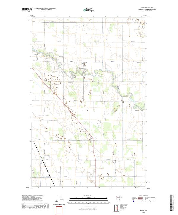
2022 Map of Hazel
USGS Topo · Published 2022About this map
Red Lake River meanders across this Pennington County landscape, defining the topography of a region dominated by rectilinear section lines and rural homesteads. The small settlement of Hazel sits near the intersection of Co Hwy 20 and Co Rd 57, serving as a local point of reference in an area primarily defined by agriculture and natural drainage. To the north, the Red Lake River Trl follows the water's winding course through the prairie, passing near family and community landmarks like Emanuel Cem and Bethania Cem. The network of secondary roads, such as Co Rd 61 and Co Hwy 7, illustrates the organized grid system of the Public Land Survey System that governs the layout of the townships T153N R42W and T154N R43W.
Find a feature on this map
52 named features on this map. Tap any name to fly to it.
Don’t see what you’re looking for? This feature index may not catch every label — zoom into the map to look around manually.
Map Details
Editions of this 2022 Hazel Map
This is the sole edition of this map. No revisions or reprints were ever made.
Other maps of this area

1918 · Terrebonne
USGS Topo · 1:62,500

1919 · Grit
USGS Topo · 1:62,500

1943 · Thief River Falls
USGS Topo · 1:62,500

1952 · Grand Forks
USGS Topo · 1:250,000

1952 · Thief River Falls
USGS Topo · 1:250,000

1954 · Bemidji
USGS Topo · 1:250,000

1954 · Roseau
USGS Topo · 1:250,000

1956 · Thief River Falls
USGS Topo · 1:250,000

1956 · Grand Forks
USGS Topo · 1:250,000

1957 · Roseau
USGS Topo · 1:250,000