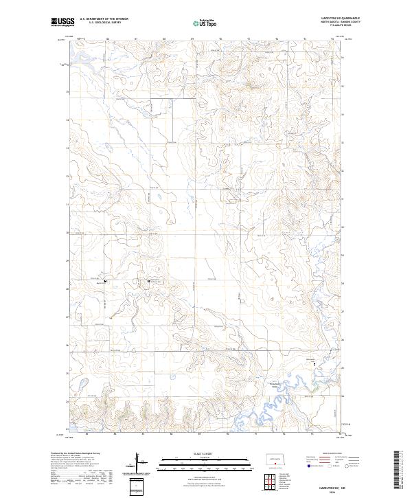
2024 Map of Hazelton SW
USGS Topo · Published 2024About this map
Horsehead Valley dominates the southeastern terrain of this Emmons County landscape, where the seasonal waters of Sand Creek and Beaver Creek carve through the North Dakota prairie. The map documents a sparsely populated rural district defined by its section-line road grid, including Main Ave and 72nd St SW, which serve isolated farmsteads and agricultural operations. For genealogists and local historians, the sheet is a vital record of the community's spiritual and physical roots, preserving the locations of the Winchester Cem, Saint Johns Lutheran Cem, and the Baptist Cem. To the northwest, the protected wetlands and grasslands of the Sunburst Lake National Wildlife Refuge provide a stark contrast to the surrounding cultivated lands, illustrating the region's commitment to preserving its original prairie character.
Find a feature on this map
32 named features on this map. Tap any name to fly to it.
Don’t see what you’re looking for? This feature index may not catch every label — zoom into the map to look around manually.
Map Details
Editions of this 2024 Hazelton SW Map
This is the sole edition of this map. No revisions or reprints were ever made.
Other maps of this area

1954 · Bismarck
USGS Topo · 1:250,000

1958 · Bismarck
USGS Topo · 1:250,000

1968 · Cannon Ball
USGS Topo · 1:24,000

1968 · Cannon Ball SE
USGS Topo · 1:24,000

1968 · Fort Yates NE
USGS Topo · 1:24,000

1971 · Grassna NW
USGS Topo · 1:24,000

1971 · Hazelton
USGS Topo · 1:24,000

1971 · Hazelton SW
USGS Topo · 1:24,000

1971 · Grassna NE
USGS Topo · 1:24,000
1971 · Hazelton NW
USGS Topo · 1:24,000