
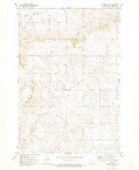
1971 Map of Hazelton SW
USGS Topo · Published 1973About this map
Horsehead Valley defines the central topography of this Emmons County landscape, where the Missouri River's influence is felt at the southern margin via Lake Oahe. The map documents a rural transition where the high ground of Prairie View overlooks the meandering courses of Beaver Creek and Sand Creek. This 1971 field-checked survey is particularly valuable for genealogists, as it clearly locates three distinct community burial grounds: Winchester Cem to the southeast, and Baptist Cem and Lutheran Cem positioned near the valley floor. In the northwest, the National Wildlife Refuge protects the waters of Sunburst Lake, while the Lawler Landing Strip serves as a lone marker of modern transportation in this primarily agricultural and conservation-focused region.
Find a feature on this map
14 named features on this map. Tap any name to fly to it.
Don’t see what you’re looking for? This feature index may not catch every label — zoom into the map to look around manually.
Map Details
Editions of this 1971 Hazelton SW Map
This is the sole edition of this map. No revisions or reprints were ever made.
Other maps of this area

1954 · Bismarck
USGS Topo · 1:250,000

1958 · Bismarck
USGS Topo · 1:250,000

1968 · Cannon Ball
USGS Topo · 1:24,000

1968 · Cannon Ball SE
USGS Topo · 1:24,000

1968 · Fort Yates NE
USGS Topo · 1:24,000

1971 · Grassna NW
USGS Topo · 1:24,000

1971 · Hazelton
USGS Topo · 1:24,000

1971 · Grassna NE
USGS Topo · 1:24,000
1971 · Hazelton NW
USGS Topo · 1:24,000

1971 · Temvik
USGS Topo · 1:24,000