
1971 Map of Temvik
USGS Topo · Published 1973About this map
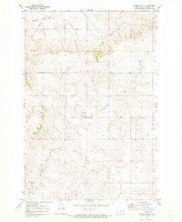
The small community of Temvik stands as the primary settlement in this 1971 study of Emmons County, situated along the Burlington Northern railroad corridor. The landscape is defined by the significant drainages of Beaver Creek in the south and the meandering path of Sand Creek and Spring Creek further north. Prominent landmarks like Temvik Butte and Winchester Butte rise above the surrounding prairie, offering distinct navigational points across the township lines of the Danbury and Prairie View areas. Local history is anchored by the Temvik Cem and Sand Creek Cem, which, along with the centrally located Townhall, indicate the civic and social centers of this rural agricultural region. The inclusion of modern infrastructure like a Substation and Sewage Disposal Ponds near the creek reflects the early 1970s development in this section of North Dakota.
Find a feature on this map
22 named features on this map. Tap any name to fly to it.
Don’t see what you’re looking for? This feature index may not catch every label — zoom into the map to look around manually.
Map Details
Editions of this 1971 Temvik Map
This is the sole edition of this map. No revisions or reprints were ever made.
Other maps of this area

1954 · Bismarck
USGS Topo · 1:250,000

1958 · Bismarck
USGS Topo · 1:250,000

1971 · Grassna NW
USGS Topo · 1:24,000

1971 · Hazelton
USGS Topo · 1:24,000

1971 · Hazelton SW
USGS Topo · 1:24,000

1971 · Grassna NE
USGS Topo · 1:24,000
1971 · Hazelton NW
USGS Topo · 1:24,000

1971 · Strasburg
USGS Topo · 1:24,000

1975 · Appert Lake
USGS Topo · 1:24,000
1980 · Linton
USGS Topo · 1:24,000