
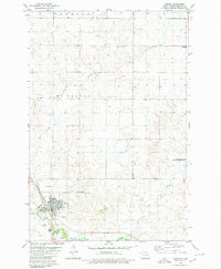
1975 Map of Appert Lake
USGS Topo · Published 1978About this map
Appert Lake National Wildlife Refuge anchors this mid-1970s topographic survey of the North Dakota prairie, centered on the water bodies and drainages that define the local ecology. The landscape is characterized by the townships of Hazelton and Danbury, where a network of section lines and fence lines reflects the systematic agricultural organization of Emmons County. Hydrological features such as Appert Lake, West Branch Long Lake Creek, and Spring Creek wind through the terrain, illustrating the natural drainage patterns of the Missouri Plateau. A localized Gravel Pit near the southern margin indicates the small-scale extractive activity supporting local road maintenance and construction during this era. The map provides a detailed view of the rural infrastructure, from individual farmstead locations to the intricate field boundaries captured by 1974 aerial photography.
Find a feature on this map
7 named features on this map. Tap any name to fly to it.
Don’t see what you’re looking for? This feature index may not catch every label — zoom into the map to look around manually.
Map Details
Editions of this 1975 Appert Lake Map
This is the sole edition of this map. No revisions or reprints were ever made.
Other maps of this area

1954 · Bismarck
USGS Topo · 1:250,000

1958 · Bismarck
USGS Topo · 1:250,000

1971 · Hazelton
USGS Topo · 1:24,000

1971 · Moffit SE
USGS Topo · 1:24,000

1971 · Temvik
USGS Topo · 1:24,000

1975 · Dana
USGS Topo · 1:24,000

1975 · Linton NE
USGS Topo · 1:24,000

1975 · Braddock
USGS Topo · 1:24,000

1979 · Bismarck
USGS Topo · 1:100,000
1980 · Linton
USGS Topo · 1:24,000