
1971 Map of Moffit SE
USGS Topo · Published 1973About this map
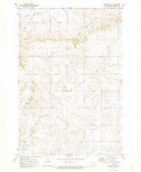
Hazelton marks the southeastern corner of this North Dakota landscape, situated at the junction of the Burlington Northern railroad and the local highway system. The terrain is defined by the broad expanse of the Buchanan Valley, which transitions into a complex network of wetlands and drainage patterns. Large hydrologic features like Dutton Slough dominate the central-north portion of the map, while several watercourses including Hawk Creek, Long Lake Creek, and Badger Creek wind through the prairie. In the northwest, a localized Townhall indicates a community focal point for the rural residents of the valley. The presence of several Gravel Pits scattered across the township lines points to the importance of aggregate extraction for road building in this period of Emmons County history.
Find a feature on this map
10 named features on this map. Tap any name to fly to it.
Don’t see what you’re looking for? This feature index may not catch every label — zoom into the map to look around manually.
Map Details
Editions of this 1971 Moffit SE Map
This is the sole edition of this map. No revisions or reprints were ever made.
Other maps of this area

1954 · Bismarck
USGS Topo · 1:250,000

1958 · Bismarck
USGS Topo · 1:250,000

1971 · Moffit SW
USGS Topo · 1:24,000

1971 · Hazelton
USGS Topo · 1:24,000

1971 · Moffit NW
USGS Topo · 1:24,000
1971 · Hazelton NW
USGS Topo · 1:24,000

1971 · Moffit
USGS Topo · 1:24,000

1975 · Dana
USGS Topo · 1:24,000

1975 · Appert Lake
USGS Topo · 1:24,000
1975 · Braddock NW
USGS Topo · 1:24,000