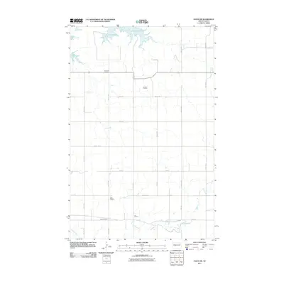
2011 Map of Hazen NW
USGS Topo · Published 2011About this map
Immanuel Cemetery and Weiderich Cemetery stand as quiet landmarks in this rural Mercer County landscape, illustrating the family and community foundations of the northern plains. This early 21st-century survey reveals a highly organized township-and-range grid system, where long-established section roads like 56th Ave NW and County Rd-9 facilitate travel between scattered homesteads. The northern edge of the map is defined by the irregular, winding shoreline of Lake Sakakawea, while Antelope Creek meanders through the southern reaches. The distribution of small burial grounds, including Saint Martin Cemetery, Bethel Cemetery, and Link Cemetery, provides essential geographic markers for genealogists and local historians tracing the lineage of the rural population near the Main St corridor.
Find a feature on this map
25 named features on this map. Tap any name to fly to it.
Don’t see what you’re looking for? This feature index may not catch every label — zoom into the map to look around manually.
Map Details
Editions of this 2011 Hazen NW Map
This is the sole edition of this map. No revisions or reprints were ever made.
Other maps of this area

1954 · McClusky
USGS Topo · 1:250,000

1958 · McClusky
USGS Topo · 1:250,000

1967 · Emmet SE
USGS Topo · 1:24,000

1967 · Blackwater Lake SE
USGS Topo · 1:24,000

1967 · Emmet SW
USGS Topo · 1:24,000

1968 · Beulah
USGS Topo · 1:24,000

1968 · Hazen West
USGS Topo · 1:24,000

1968 · Hazen East
USGS Topo · 1:24,000

1969 · Hazen NE
USGS Topo · 1:24,000

1969 · Beulah NE
USGS Topo · 1:24,000