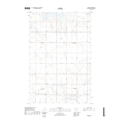
2018 Map of Hazen NW
USGS Topo · Published 2018About this map
Lake Sakakawea dominates the northern reaches of this Mercer County landscape, where the waters of Expansion Bay and Beulah Bay cut into the prairie uplands. This 2018 survey reveals a terrain defined by the Public Land Survey System, with a rigid grid of section roads like Co Rd 9 and 55th Ave NW navigating the coulees. For those tracing local history or genealogy, the map identifies several rural burial grounds that anchor the farming community, including Immanuel Cem, Weiderich Cem, and Link Cem. To the south, the landscape transitions toward the drainage of Antelope Cr, maintaining the characteristic North Dakota pattern of dispersed farmsteads and small country cemeteries like Saint Martin Cem and Bethel Cem situated far from municipal centers.
Find a feature on this map
37 named features on this map. Tap any name to fly to it.
Don’t see what you’re looking for? This feature index may not catch every label — zoom into the map to look around manually.
Map Details
Editions of this 2018 Hazen NW Map
This is the sole edition of this map. No revisions or reprints were ever made.
Other maps of this area

1954 · McClusky
USGS Topo · 1:250,000

1958 · McClusky
USGS Topo · 1:250,000

1967 · Emmet SE
USGS Topo · 1:24,000

1967 · Blackwater Lake SE
USGS Topo · 1:24,000

1967 · Emmet SW
USGS Topo · 1:24,000

1968 · Beulah
USGS Topo · 1:24,000

1968 · Hazen West
USGS Topo · 1:24,000

1968 · Hazen East
USGS Topo · 1:24,000

1969 · Hazen NE
USGS Topo · 1:24,000

1969 · Beulah NE
USGS Topo · 1:24,000