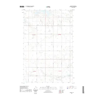
2020 Map of Hazen NW
USGS Topo · Published 2020About this map
The Missouri River flows along the northern edge of this Mercer County landscape, where the waters of Lake Sakakawea meet the shoreline at Beulah Bay. The interior terrain is defined by a grid of rural roads and section lines that cross the prairie south of the river. This map is particularly significant for its documentation of family and community burial sites, recording the locations of Immanuel Cem, Weiderich Cem, and Saint Martin Cem. Further south, Link Cem and Bethel Cem sit within the drainage area of Antelope Cr. The map preserves the modern distribution of these small, localized landmarks alongside the natural hydrology and the large-scale impoundment of the Missouri. It serves as a clear record of the intersection between the region’s agricultural development and its historical spiritual and social centers.
Find a feature on this map
36 named features on this map. Tap any name to fly to it.
Don’t see what you’re looking for? This feature index may not catch every label — zoom into the map to look around manually.
Map Details
Editions of this 2020 Hazen NW Map
This is the sole edition of this map. No revisions or reprints were ever made.
Other maps of this area

1954 · McClusky
USGS Topo · 1:250,000

1958 · McClusky
USGS Topo · 1:250,000

1967 · Emmet SE
USGS Topo · 1:24,000

1967 · Blackwater Lake SE
USGS Topo · 1:24,000

1967 · Emmet SW
USGS Topo · 1:24,000

1968 · Beulah
USGS Topo · 1:24,000

1968 · Hazen West
USGS Topo · 1:24,000

1968 · Hazen East
USGS Topo · 1:24,000

1969 · Hazen NE
USGS Topo · 1:24,000

1969 · Beulah NE
USGS Topo · 1:24,000