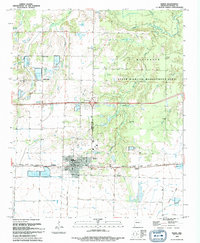
1994 Map of Hazen
USGS Topo · Published 1994About this map
Hazen serves as the primary hub of this Arkansas landscape, characterized by its grid of rural roads and water management features. The town features a concentrated residential core with a High School, Armory, and Library, while an extensive network of reservoirs and ponds like Sims Reservoir and Novak Res indicates the importance of irrigation and water control in the local economy. To the north and east, the Wattensaw State Wildlife Management Area covers a significant portion of the terrain, preserves the natural character of Wattensaw Bayou and its surrounding wetlands. Smaller settlements like Tarnceville and Center Point punctuate the agricultural land, while the Railroad Prairie State Natural Area follows the path of the tracks east of town. Local history is anchored by sites such as Hazen Cemetery and the Old Bethel Cemetery, alongside family-named landmarks like Crowley Lake and Jerome Lake.
Find a feature on this map
40 named features on this map. Tap any name to fly to it.
Don’t see what you’re looking for? This feature index may not catch every label — zoom into the map to look around manually.
Map Details
Editions of this 1994 Hazen Map
This is the sole edition of this map. No revisions or reprints were ever made.
Other maps of this area

1935 · Hazen
USGS Topo · 1:62,500

1935 · Clarendon
USGS Topo · 1:62,500

1937 · Stuttgart
USGS Topo · 1:62,500

1939 · Stuttgart
USGS Topo · 1:62,500

1941 · Hazen
USGS Topo · 1:62,500

1941 · De Valls Bluff
USGS Topo · 1:62,500

1941 · Clarendon
USGS Topo · 1:62,500

1948 · Helena
USGS Topo · 1:250,000

1950 · Helena
USGS Topo · 1:250,000

1955 · Helena
USGS Topo · 1:250,000