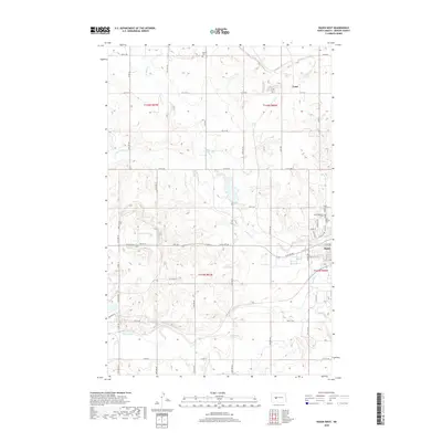
2018 Map of Hazen West
USGS Topo · Published 2018About this map
The Knife River flows across this Mercer County landscape, where the prairie transitions into the western outskirts of Hazen. This modern survey reveals a region defined by its watercourses and rural burial sites, including the Wolfe Cem and a cluster of religious grounds such as Saint Martins Cem, Peace Lutheran Cem, and Saint Matthews Cem. The drainage patterns of Antelope Cr and its western branch, W Br Antelope Cr, dictate the layout of the section-line road network, which remains largely composed of unpaved routes like Co RD 19 and Co RD 9. To the north, the small settlement of Truax sits near the upper reaches of the drainage system. The map captures the quiet intersection of agricultural land and the sprawling tributaries of the Knife River, providing a clear view of the area's contemporary topography and local heritage sites before they are further impacted by development or energy industry activity.
Find a feature on this map
44 named features on this map. Tap any name to fly to it.
Don’t see what you’re looking for? This feature index may not catch every label — zoom into the map to look around manually.
Map Details
Editions of this 2018 Hazen West Map
This is the sole edition of this map. No revisions or reprints were ever made.
Other maps of this area

1954 · McClusky
USGS Topo · 1:250,000

1958 · McClusky
USGS Topo · 1:250,000

1968 · Red Butte
USGS Topo · 1:24,000

1968 · Beulah
USGS Topo · 1:24,000

1968 · Medicine Butte NE
USGS Topo · 1:24,000

1968 · Red Butte NW
USGS Topo · 1:24,000

1968 · Hazen West
USGS Topo · 1:24,000

1968 · Hazen East
USGS Topo · 1:24,000

1969 · Hazen NE
USGS Topo · 1:24,000

1969 · Beulah NE
USGS Topo · 1:24,000