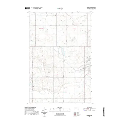
2020 Map of Hazen West
USGS Topo · Published 2020About this map
The Knife River and its varied tributaries, including Antelope Creek and Beulah Cr, define the drainage patterns of this Mercer County landscape. The western edge of Hazen and the northeastern portion of Beulah are visible, connected by HGY 200 as it traverses the valley. A high concentration of rural burial sites, including Saint Martins Cem, Saint Matthews Cem, and Hazen Cem, cluster near the eastern boundary, suggesting a dense early settlement history and community ties rooted in these townships. Further north, the small siding or locality of Truax sits along the section lines near the Wolfe Cem, illustrating the dispersed nature of the agricultural economy in this part of North Dakota. The terrain transitions from river bottomlands to higher coulees, with several branches of Antelope Cr carving the northern uplands.
Find a feature on this map
42 named features on this map. Tap any name to fly to it.
Don’t see what you’re looking for? This feature index may not catch every label — zoom into the map to look around manually.
Map Details
Editions of this 2020 Hazen West Map
This is the sole edition of this map. No revisions or reprints were ever made.
Other maps of this area

1954 · McClusky
USGS Topo · 1:250,000

1958 · McClusky
USGS Topo · 1:250,000

1968 · Red Butte
USGS Topo · 1:24,000

1968 · Beulah
USGS Topo · 1:24,000

1968 · Medicine Butte NE
USGS Topo · 1:24,000

1968 · Red Butte NW
USGS Topo · 1:24,000

1968 · Hazen West
USGS Topo · 1:24,000

1968 · Hazen East
USGS Topo · 1:24,000

1969 · Hazen NE
USGS Topo · 1:24,000

1969 · Beulah NE
USGS Topo · 1:24,000