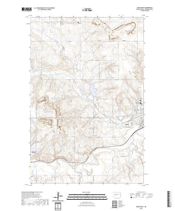
2024 Map of Hazen West
USGS Topo · Published 2024About this map
The Knife River winds through the southern landscape of this Mercer County region, marking a corridor of development between the growing communities of Beulah and Hazen. While HGY 200 serves as the primary modern thoroughfare connecting these towns, the surrounding prairie is defined by a rigorous grid of section lines and gravel roads like Co RD 19 and Co RD 9. This modern survey illustrates the proximity of historical local landmarks to modern infrastructure, such as the Peace Lutheran Cem, Saint Martins Cem, and Hazen Cem clustered north of the Hazen townsite.
Find a feature on this map
38 named features on this map. Tap any name to fly to it.
Don’t see what you’re looking for? This feature index may not catch every label — zoom into the map to look around manually.
Map Details
Editions of this 2024 Hazen West Map
This is the sole edition of this map. No revisions or reprints were ever made.
Other maps of this area

1954 · McClusky
USGS Topo · 1:250,000

1958 · McClusky
USGS Topo · 1:250,000

1968 · Red Butte
USGS Topo · 1:24,000

1968 · Beulah
USGS Topo · 1:24,000

1968 · Medicine Butte NE
USGS Topo · 1:24,000

1968 · Red Butte NW
USGS Topo · 1:24,000

1968 · Hazen West
USGS Topo · 1:24,000

1968 · Hazen East
USGS Topo · 1:24,000

1969 · Hazen NE
USGS Topo · 1:24,000

1969 · Beulah NE
USGS Topo · 1:24,000