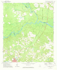
1971 Map of Hazlehurst North
USGS Topo · Published 1974About this map
Hazlehurst serves as the primary regional hub in the early 1970s, where the Southern and Central Of Georgia railroads converge. The landscape is defined by the significant confluence of the Ocmulgee River and Oconee River, which join to form the Altamaha River. This river system creates a complex network of landings and bluffs, including Town Bluff Landing and Bells Ferry Landing, reflecting a legacy of river-based transport and commerce. Inland, the map reveals a rural community structured around family-named landmarks and local institutions, such as Philadelphia Ch and Big Bethel Ch. The presence of numerous small burial grounds like Mobley Cem and Lynn Cem provides valuable data for genealogists tracing South Georgia families. The terrain transitions from the low-lying river bottoms to the higher ground of the Jeff Davis Country Club and the emerging suburbs near Palms Memorial Gardens.
Find a feature on this map
48 named features on this map. Tap any name to fly to it.
Don’t see what you’re looking for? This feature index may not catch every label — zoom into the map to look around manually.
Map Details
Editions of this 1971 Hazlehurst North Map
2 editions found
Other maps of this area

1953 · Waycross
USGS Topo · 1:250,000

1957 · Macon
USGS Topo · 1:250,000

1958 · Macon
USGS Topo · 1:250,000

1958 · Waycross
USGS Topo · 1:250,000

1964 · Macon
USGS Topo · 1:250,000

1970 · Alston
USGS Topo · 1:24,000

1970 · Uvalda
USGS Topo · 1:24,000

1970 · Jordan
USGS Topo · 1:24,000

1970 · Pine Grove
USGS Topo · 1:24,000
1970 · Grays Landing
USGS Topo · 1:24,000