
1971 Map of Hazlehurst South
USGS Topo · Published 1974About this map
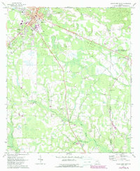
Hazlehurst serves as the focal point of this 1971 study, appearing at a time of established growth at the intersection of the Southern and Central Of Georgia railroads. The town's civic core is clearly defined, featuring the Courthouse, City Hall, and a dedicated Hosp. Outside the residential grid, the landscape transitions into a network of drainages and timbered tracts, dominated by the winding course of Big Satilla Creek and its many tributaries like Hurricane Creek and Big Branch.
Find a feature on this map
33 named features on this map. Tap any name to fly to it.
Don’t see what you’re looking for? This feature index may not catch every label — zoom into the map to look around manually.
Map Details
Editions of this 1971 Hazlehurst South Map
2 editions found
Other maps of this area

1953 · Waycross
USGS Topo · 1:250,000

1958 · Waycross
USGS Topo · 1:250,000

1970 · Pine Grove
USGS Topo · 1:24,000
1970 · Grays Landing
USGS Topo · 1:24,000

1971 · Nicholls NE
USGS Topo · 1:24,000

1971 · Roper
USGS Topo · 1:24,000
1971 · Hazlehurst North
USGS Topo · 1:24,000

1971 · Alma NW
USGS Topo · 1:24,000

1971 · Denton
USGS Topo · 1:24,000
1971 · Lumber City
USGS Topo · 1:24,000