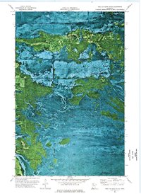
1973 Map of Head of Rapid River
USGS Topo · Published 1976About this map
Beltrami Island State Forest dominates this northern Minnesota landscape, where the Red Lake Indian Reservation meets extensive conservation lands. This 1970s orthophotomap provides a rare look at the drainage patterns near the Rapid River headwaters, showing a complex network of wetlands and forested tracts. The interplay of administrative boundaries is evident across the sheet, particularly where the Red Lake State Wildlife Management Area and Steenerson State Wildlife Management Area intersect.
Find a feature on this map
13 named features on this map. Tap any name to fly to it.
Don’t see what you’re looking for? This feature index may not catch every label — zoom into the map to look around manually.
Map Details
Editions of this 1973 Head of Rapid River Map
This is the sole edition of this map. No revisions or reprints were ever made.
Other maps of this area

1918 · F
USGS Topo · 1:62,500

1918 · Malcolm
USGS Topo · 1:62,500

1918 · Jelle
USGS Topo · 1:62,500

1954 · Roseau
USGS Topo · 1:250,000

1957 · Roseau
USGS Topo · 1:250,000

1958 · Roseau
USGS Topo · 1:250,000

1973 · Gates Corner
USGS Topo · 1:24,000

1973 · Manomin Creek
USGS Topo · 1:24,000

1973 · Jelle NE
USGS Topo · 1:24,000

1973 · Thorhult
USGS Topo · 1:24,000