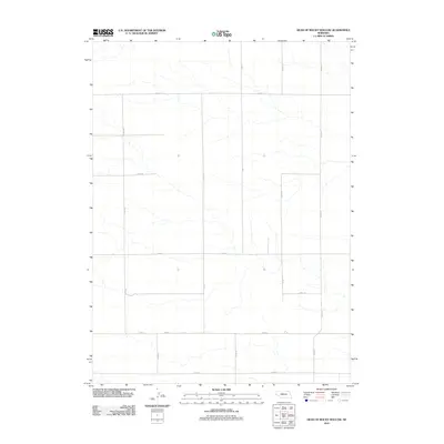
2011 Map of Head of Rocky Hollow
USGS Topo · Published 2011About this map
Intermittent drainage channels carve through the High Plains landscape of Banner County in this 2011 topographic study. The area is defined by a rigid grid of rural corridors, where major thoroughfares like Road 14 and Co Rd 1 provide the primary access through the open terrain. This sparsely populated region of Nebraska reflects a modern agricultural and ranching layout, with the surveyor's precision capturing the subtle elevation changes that direct local hydrology. Navigational markers such as Co Rd 10, Co Rd 6, and Co Rd 104 delineate land use patterns and property boundaries characteristic of the state's panhandle. The map focuses on the physical geography and the essential road network, including north-south routes like Co Rd 19 and Co Rd 17, which connect the disparate sections of this quiet prairie landscape.
Find a feature on this map
16 named features on this map. Tap any name to fly to it.
Don’t see what you’re looking for? This feature index may not catch every label — zoom into the map to look around manually.
Map Details
Editions of this 2011 Head of Rocky Hollow Map
This is the sole edition of this map. No revisions or reprints were ever made.
Other maps of this area

1898 · Scotts Bluff
USGS Topo · 1:125,000

1899 · Goshen Hole
USGS Topo · 1:125,000

1954 · Scottsbluff
USGS Topo · 1:250,000

1954 · Cheyenne
USGS Topo · 1:250,000

1958 · Cheyenne
USGS Topo · 1:250,000

1958 · Scottsbluff
USGS Topo · 1:250,000

1960 · Tremain
USGS Topo · 1:24,000

1963 · Lindbergh
USGS Topo · 1:24,000

1973 · Kimball 2 NE
USGS Topo · 1:24,000

1973 · Kimball 2 SE
USGS Topo · 1:24,000