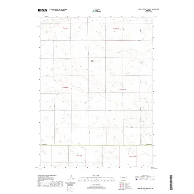
2017 Map of Head of Rocky Hollow
USGS Topo · Published 2017About this map
Rocky Hollow defines the central terrain of this high plains landscape on the border of Banner and Kimball Counties. This area of western Nebraska is characterized by an extensive network of rural section roads, including Co Rd 14 and Co Rd 9, which delineate the expansive agricultural and grazing lands of the panhandle. The map illustrates the transition between the townships of t17n r58w and t17n r57w, capturing the precise jurisdictional boundaries where Co Rd 56 and Kimball Co Rd meet the county line. This 2017 survey provides a clear view of the modern rural infrastructure, showing the persistence of the Public Land Survey System grid and the specific placement of drainage features and terrain contours that shape this corner of the state.
Find a feature on this map
20 named features on this map. Tap any name to fly to it.
Don’t see what you’re looking for? This feature index may not catch every label — zoom into the map to look around manually.
Map Details
Editions of this 2017 Head of Rocky Hollow Map
This is the sole edition of this map. No revisions or reprints were ever made.
Other maps of this area

1898 · Scotts Bluff
USGS Topo · 1:125,000

1899 · Goshen Hole
USGS Topo · 1:125,000

1954 · Scottsbluff
USGS Topo · 1:250,000

1954 · Cheyenne
USGS Topo · 1:250,000

1958 · Cheyenne
USGS Topo · 1:250,000

1958 · Scottsbluff
USGS Topo · 1:250,000

1960 · Tremain
USGS Topo · 1:24,000

1963 · Lindbergh
USGS Topo · 1:24,000

1973 · Kimball 2 NE
USGS Topo · 1:24,000

1973 · Kimball 2 SE
USGS Topo · 1:24,000