
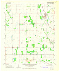
1964 Map of Headrick
USGS Topo · Published 1965About this map
The North Fork Red River carves a sharp boundary between Jackson and Kiowa counties, framing a landscape defined by the juxtaposition of the steep Navajo Mountains and the irrigated agricultural plains below. The presence of the Ozark Canal, a Flume, and Sinking Creek suggests a highly managed water system supporting the local farm economy. Small community centers like Friendship and Ozark are anchored by local institutions such as Friendship Ch and the Navajo Sch, while the Navajo Cem sits on the lower slopes near the river's bend.
Find a feature on this map
21 named features on this map. Tap any name to fly to it.
Don’t see what you’re looking for? This feature index may not catch every label — zoom into the map to look around manually.
Map Details
Editions of this 1964 Headrick Map
This is the sole edition of this map. No revisions or reprints were ever made.
Other maps of this area

1955 · Lawton
USGS Topo · 1:250,000

1963 · Altus SE
USGS Topo · 1:24,000

1964 · Tipton SE
USGS Topo · 1:24,000

1964 · Altus
USGS Topo · 1:24,000

1964 · Tipton
USGS Topo · 1:24,000

1964 · Warren
USGS Topo · 1:24,000
1964 · Roosevelt
USGS Topo · 1:24,000

1964 · Long Mountain
USGS Topo · 1:24,000

1971 · Blair
USGS Topo · 1:24,000

1985 · Altus
USGS Topo · 1:100,000