
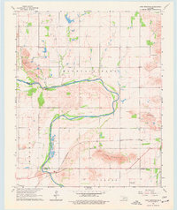
1964 Map of Long Mountain
USGS Topo · Published 1965About this map
The North Fork Red River snakes across this southwestern Oklahoma landscape, carving a prominent valley between Dempsey Peak and the namesake Long Mountain. In the mid-1960s, this area at the intersection of Kiowa, Tillman, and Jackson Counties was defined by its geological features and transport corridors. The St Louis - San Francisco railroad cuts through the southern terrain, passing near the small settlement of Luce and numerous industrial Sandpits.
Find a feature on this map
21 named features on this map. Tap any name to fly to it.
Don’t see what you’re looking for? This feature index may not catch every label — zoom into the map to look around manually.
Map Details
Editions of this 1964 Long Mountain Map
2 editions found
Other maps of this area

1949 · Cooperton
USGS Topo · 1:62,500

1950 · Snyder
USGS Topo · 1:62,500

1955 · Lawton
USGS Topo · 1:250,000

1956 · Glen Mountains
USGS Topo · 1:24,000

1956 · Manitou
USGS Topo · 1:24,000

1956 · Snyder
USGS Topo · 1:24,000

1956 · Snyder
USGS Topo · 1:62,500

1956 · Cooperton
USGS Topo · 1:62,500

1964 · Tipton SE
USGS Topo · 1:24,000

1964 · Tipton
USGS Topo · 1:24,000