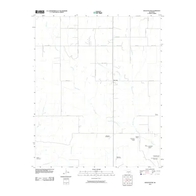
2010 Map of Healdton SW
USGS Topo · Published 2010About this map
Post Oak serves as the central point for this landscape in Carter County, characterized by a dense network of local roads and water management sites. The terrain is defined by the winding paths of Simon Creek and North Simon Creek, which draw through a region marked by numerous small reservoirs such as Lower Bayou Creek Site 13 Dam. These dams and the surrounding topography, including Brushy Mountain and Townley Hollow, indicate a rural area focused on ranching or agriculture where water control is essential to the landscape's utility. Local naming conventions appear throughout the road network, with evocative labels like Rattle Snake Rd and Water Moccasin Rd hinting at the local environment. For genealogists, the map preserves the exact locations of Morgan Cemetery and Simon Cemetery, providing critical spatial context for family history research in this part of Oklahoma.
Find a feature on this map
37 named features on this map. Tap any name to fly to it.
Don’t see what you’re looking for? This feature index may not catch every label — zoom into the map to look around manually.
Map Details
Editions of this 2010 Healdton SW Map
This is the sole edition of this map. No revisions or reprints were ever made.
Other maps of this area

1901 · Addington
USGS Topo · 1:125,000

1901 · Ardmore
USGS Topo · 1:125,000

1902 · Gainesville
USGS Topo · 1:125,000

1905 · Montague
USGS Topo · 1:125,000

1918 · Ardmore
USGS Topo · 1:125,000

1943 · Gainesville
USGS Topo · 1:125,000

1954 · Sherman
USGS Topo · 1:250,000

1957 · Ardmore
USGS Topo · 1:250,000

1958 · Sherman
USGS Topo · 1:250,000

1963 · Ardmore
USGS Topo · 1:250,000