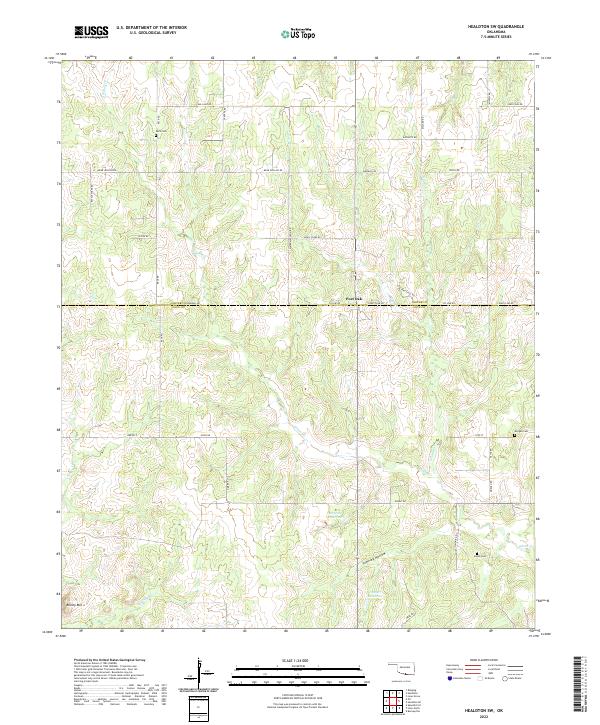
2022 Map of Healdton SW
USGS Topo · Published 2022About this map
Simon Creek and its tributary North Simon Creek dominate this landscape along the border of Carter and Love Counties. The terrain transitions from the elevations of Brushy Mountain in the southwest toward the drainage basins of Townley Hollow and East Sandy Creek. Rural life is centered around the small settlement of Post Oak and several burial grounds that mark the local heritage, including Reck Cemetery, Morgan Cemetery, and Simon Cemetery. The area is networked by a grid of named rural roads such as Bear Hollow Road, Water Moccasin Road, and Rattle Snake Road, reflecting the local flora and fauna. These roads provide access to several water management features, including 085008 Reservoir and 085007 Reservoir, which support the agricultural character of this southern Oklahoma region.
Find a feature on this map
41 named features on this map. Tap any name to fly to it.
Don’t see what you’re looking for? This feature index may not catch every label — zoom into the map to look around manually.
Map Details
Editions of this 2022 Healdton SW Map
This is the sole edition of this map. No revisions or reprints were ever made.
Other maps of this area

1901 · Addington
USGS Topo · 1:125,000

1901 · Ardmore
USGS Topo · 1:125,000

1902 · Gainesville
USGS Topo · 1:125,000

1905 · Montague
USGS Topo · 1:125,000

1918 · Ardmore
USGS Topo · 1:125,000

1943 · Gainesville
USGS Topo · 1:125,000

1954 · Sherman
USGS Topo · 1:250,000

1957 · Ardmore
USGS Topo · 1:250,000

1958 · Sherman
USGS Topo · 1:250,000

1963 · Ardmore
USGS Topo · 1:250,000