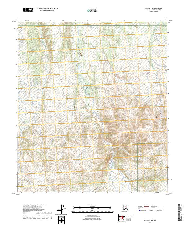
2024 Map of Healy D-6 NW
USGS Topo · Published 2024About this map
Sushana River flows northward through this Interior Alaska landscape, cutting through the high country of the Alaska Range. Much of the southern and central terrain is protected within the boundaries of Denali National Park, where the topography transitions from steep, ridged peaks into broader river valleys and expansive wetlands. The map illustrates the complex hydrography of the region, featuring numerous smaller tributaries and seasonal drainages that feed the river system. While largely devoid of modern road infrastructure, the area is defined by its topographic relief and the distinct township and range boundaries of t11s r12w and t12s r12w, which provide a vital framework for navigating this roadless wilderness.
Find a feature on this map
8 named features on this map. Tap any name to fly to it.
Don’t see what you’re looking for? This feature index may not catch every label — zoom into the map to look around manually.
Map Details
Editions of this 2024 Healy D-6 NW Map
This is the sole edition of this map. No revisions or reprints were ever made.
Other maps of this area

1948 · Kantishna River
USGS Topo · 1:250,000

1950 · Fairbanks
USGS Topo · 1:250,000

1951 · Healy
USGS Topo · 1:250,000

1951 · Kantishna River
USGS Topo · 1:250,000

1951 · Fairbanks
USGS Topo · 1:250,000

1951 · Mount McKinley D-1
USGS Topo · 1:63,360

1951 · Healy D-6
USGS Topo · 1:63,360

1952 · Mount McKinley
USGS Topo · 1:250,000

1952 · Fairbanks A-6
USGS Topo · 1:63,360

1952 · Kantishna River A-1
USGS Topo · 1:63,360