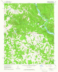
1964 Map of Heardmont
USGS Topo · Published 1966About this map
Heardmont and the surrounding Elbert County countryside appear here just as the landscape began to shift with the development of the Savannah River valley. The Seaboard Air Line railroad forms a primary transit corridor, connecting the settlements of Pearl and Beverly through the wooded terrain. This era shows a dense network of local community life, centered on numerous rural congregations such as New Hope Ch, Bethel Grove Ch, and Hunters Chapel. To the east, the river remains in its more natural state near Trotters Shoals and Paris Island, though the southern edge of the map identifies the early Reservation Boundary for the Clark Hill Reservoir. This transition from a river-and-rail economy to a reservoir-impacted landscape is documented through labels like the Banks Sch and the secluded Gods Acre Cem, which ground the genealogy of the area in its physical landmarks.
Find a feature on this map
37 named features on this map. Tap any name to fly to it.
Don’t see what you’re looking for? This feature index may not catch every label — zoom into the map to look around manually.
Map Details
Editions of this 1964 Heardmont Map
Other maps of this area

1893 · Elberton
USGS Topo · 1:125,000

1906 · Crawfordville
USGS Topo · 1:125,000

1953 · Athens
USGS Topo · 1:250,000

1954 · Greenville
USGS Topo · 1:250,000

1955 · Broad
USGS Topo · 1:24,000

1955 · Chennault
USGS Topo · 1:24,000

1958 · Greenville
USGS Topo · 1:250,000

1958 · Athens
USGS Topo · 1:250,000

1958 · Elberton
USGS Topo · 1:62,500

1959 · Athens
USGS Topo · 1:250,000