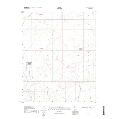
2020 Map of Heart Rock
USGS Topo · Published 2020About this map
Chaco Culture National Historical Park anchors the western edge of this landscape, preserving a portion of the high desert terrain in the Eastern Navajo Agency. The map reveals a network of service and county roads that navigate the complex topography, where the namesake Heart Rock and the deep incision of Satan Pass Canyon define the local relief. These routes, including Navajo Svc Rte 9 and Borrego Pass Rd, suggest a rural connectivity tied to the land's natural contours and historical pathways. The presence of numerous township and range lines across the high-elevation terrain reflects the formal surveying of this region, providing a clear view of the modern boundaries within the Navajo Nation as they existed in the early twenty-first century. This layout is particularly useful for understanding the proximity of natural landmarks like Heart Butte Rd to the protected historical park area.
Find a feature on this map
19 named features on this map. Tap any name to fly to it.
Don’t see what you’re looking for? This feature index may not catch every label — zoom into the map to look around manually.
Map Details
Editions of this 2020 Heart Rock Map
This is the sole edition of this map. No revisions or reprints were ever made.
Other maps of this area

1883 · Mt. Taylor
USGS Topo · 1:250,000

1886 · Wingate
USGS Topo · 1:250,000

1886 · Mt. Taylor
USGS Topo · 1:250,000

1892 · Wingate
USGS Topo · 1:250,000

1892 · Mt. Taylor
USGS Topo · 1:250,000

1899 · Mt. Taylor
USGS Topo · 1:250,000

1954 · Gallup
USGS Topo · 1:250,000

1958 · Gallup
USGS Topo · 1:250,000

1958 · Albuquerque
USGS Topo · 1:250,000

1959 · Gallup
USGS Topo · 1:250,000
Featured Places
- Eastern Navajo Agency, NM
- Littlewater, Eastern Navajo Agency
- McKinley County, NM
- United States
- New Mexico