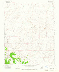
1963 Map of Heart Rock
USGS Topo · Published 1965About this map
Kin Ya-ah (Ruin) serves as a primary historical focal point within this high-desert landscape of McKinley County. This southwestern portion of the sheet is protected as part of the Chaco Canyon National Monument, highlighting the archeological significance of the region during the early 1960s. The terrain is defined by natural landmarks like the prominent Heart Rock formation and a scattered Flowing Well in the northern sections. While primarily open and arid, the map documents the sparse infrastructure of the era, including unimproved roads and state routes that connect these ancestral sites and geological features across the high plateau.
Find a feature on this map
4 named features on this map. Tap any name to fly to it.
Don’t see what you’re looking for? This feature index may not catch every label — zoom into the map to look around manually.
Map Details
Editions of this 1963 Heart Rock Map
This is the sole edition of this map. No revisions or reprints were ever made.
Other maps of this area

1883 · Mt. Taylor
USGS Topo · 1:250,000

1886 · Wingate
USGS Topo · 1:250,000

1886 · Mt. Taylor
USGS Topo · 1:250,000

1892 · Wingate
USGS Topo · 1:250,000

1892 · Mt. Taylor
USGS Topo · 1:250,000

1899 · Mt. Taylor
USGS Topo · 1:250,000

1954 · Gallup
USGS Topo · 1:250,000

1958 · Gallup
USGS Topo · 1:250,000

1958 · Albuquerque
USGS Topo · 1:250,000

1959 · Gallup
USGS Topo · 1:250,000
Featured Places
- Eastern Navajo Agency, NM
- Littlewater, Eastern Navajo Agency
- McKinley County, NM
- United States
- New Mexico