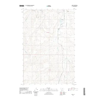
2020 Map of Heath
USGS Topo · Published 2020About this map
Heath sits at the northern edge of this Fergus County landscape, where the prairie begins to break into a complex system of drainages and high benches. The hydrology of the region is defined by the branching waters of Big Spring Creek, including the E Fork Big Spring Cr and the Middle Fork Big Spring Cr. The East Fork Reservoir serves as a significant landmark in the northeast, while the terrain to the south becomes increasingly varied with features such as Middle Fork Canyon and the curiously named Toboggan Slide. A network of rural routes like Red Hill Rd and Alaska Bench Rd provides access to the higher elevations and remote coulees. This survey also documents the Township and Range lines of t14n r19e and t13n r19e, illustrating how the Public Land Survey System has organized this western cattle country and ranching land.
Find a feature on this map
28 named features on this map. Tap any name to fly to it.
Don’t see what you’re looking for? This feature index may not catch every label — zoom into the map to look around manually.
Map Details
Editions of this 2020 Heath Map
This is the sole edition of this map. No revisions or reprints were ever made.
Other maps of this area

1889 · Big Snowy Mountain
USGS Topo · 1:250,000

1893 · Big Snowy Mountain
USGS Topo · 1:250,000

1941 · Lewistown
USGS Topo · 1:62,500

1941 · Judith Peak
USGS Topo · 1:62,500

1944 · Lewistown
USGS Topo · 1:62,500

1944 · Judith Peak
USGS Topo · 1:62,500

1954 · Roundup
USGS Topo · 1:250,000

1954 · Lewistown
USGS Topo · 1:250,000

1958 · Roundup
USGS Topo · 1:250,000

1959 · Lewistown
USGS Topo · 1:250,000