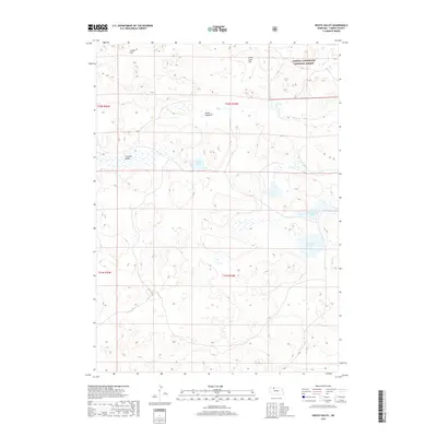
2017 Map of Heath Valley
USGS Topo · Published 2017About this map
Samuel R McKelvie National Forest dominates the northeastern corner of this 2017 survey, where the Nebraska Sandhills terrain transitions into the namesake Heath Valley. This landscape is defined by its complex network of isolated wetlands and small lakes, including Schoolhouse Lake, Twomile Lake, and the curiously named Y Lake. These water bodies are dispersed among topographic depressions like Cutcomb Valley, creating a unique hydrologic pattern characteristic of Cherry County's ranching country.
Find a feature on this map
15 named features on this map. Tap any name to fly to it.
Don’t see what you’re looking for? This feature index may not catch every label — zoom into the map to look around manually.
Map Details
Editions of this 2017 Heath Valley Map
This is the sole edition of this map. No revisions or reprints were ever made.
Other maps of this area

1950 · Powderhorn Valley
USGS Topo · 1:62,500

1950 · Cody
USGS Topo · 1:62,500

1950 · Doughboy
USGS Topo · 1:62,500

1952 · Eli
USGS Topo · 1:62,500

1952 · Doughboy
USGS Topo · 1:62,500

1957 · Valentine
USGS Topo · 1:250,000

1959 · Valentine
USGS Topo · 1:250,000

1985 · Powderhorn Valley SW
USGS Topo · 1:24,000

1985 · Heath Valley
USGS Topo · 1:24,000

1985 · Eli SE
USGS Topo · 1:24,000