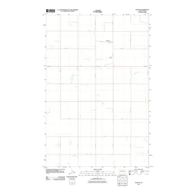
2011 Map of Heaton
USGS Topo · Published 2011About this map
Heaton stands as a quiet focal point in this central North Dakota landscape, situated along the east-west corridor of 52 200. The settlement’s small grid is defined by streets like Williams St, Kopper St, and Main St, with the Heaton Cemetery located just to the south. The natural geography is characterized by the meandering path of Pipestem Creek, which winds through the prairie, and several small potholes and wetlands typical of the region. A vast network of section roads, such as 47th Ave NE and 2nd St NE, divides the surrounding agricultural land into a strict geometric pattern, illustrating the persistent influence of the Public Land Survey System on the rural North Dakota township structure in the early 21st century.
Find a feature on this map
25 named features on this map. Tap any name to fly to it.
Don’t see what you’re looking for? This feature index may not catch every label — zoom into the map to look around manually.
Map Details
Editions of this 2011 Heaton Map
This is the sole edition of this map. No revisions or reprints were ever made.
Other maps of this area

1948 · Cathay
USGS Topo · 1:62,500

1948 · Fessenden
USGS Topo · 1:62,500

1949 · Cathay
USGS Topo · 1:24,000

1949 · Fessenden SW
USGS Topo · 1:24,000

1949 · Emrick
USGS Topo · 1:24,000

1951 · Bowdon
USGS Topo · 1:24,000

1951 · Heaton
USGS Topo · 1:24,000

1951 · Sykeston
USGS Topo · 1:24,000

1952 · New Rockford
USGS Topo · 1:250,000

1956 · New Rockford
USGS Topo · 1:250,000