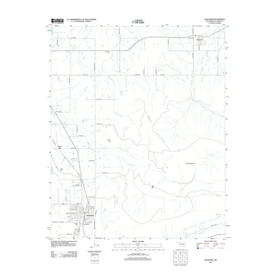
2013 Map of Heavener
USGS Topo · Published 2013About this map
Heavener anchors the southwest corner of this Oklahoma landscape, where the street grid is bisected by the rail corridor and established neighborhoods surround Oakdale Cem and Hill Cem. Moving northeast from the city, the terrain transitions into a series of distinctive peaks including Round Mtn, Lost Mtn, and the sprawling Poteau Mountain. The mapping reveals a rural network of county roads connecting smaller communities like Monroe and Springhill, each defined by its own local landmarks such as Springhill Cem. Drainage patterns are shaped by numerous tributaries including Horsepen Cr, Morris Cr, and Cowskin Cr, which wind through the valleys between the high ridges. This 2013 survey provides a clear look at the mix of residential development and traditional timbered Oklahoma highlands, including the secluded Burns Cem on the eastern edge of the quadrangle.
Find a feature on this map
63 named features on this map. Tap any name to fly to it.
Don’t see what you’re looking for? This feature index may not catch every label — zoom into the map to look around manually.
Map Details
Editions of this 2013 Heavener Map
This is the sole edition of this map. No revisions or reprints were ever made.
Other maps of this area

1887 · Poteau Mountain #2
USGS Topo · 1:62,500

1887 · Greenwood
USGS Topo · 1:62,500

1890 · Fort Smith
USGS Topo · 1:125,000

1890 · Poteau Mountain
USGS Topo · 1:125,000

1899 · Poteau Mountain
USGS Topo · 1:125,000

1900 · Sallisaw
USGS Topo · 1:125,000

1900 · Winding Stair
USGS Topo · 1:125,000

1909 · Winding Stair
USGS Topo · 1:125,000

1911 · Sallisaw
USGS Topo · 1:125,000

1943 · Fort Smith
USGS Topo · 1:125,000