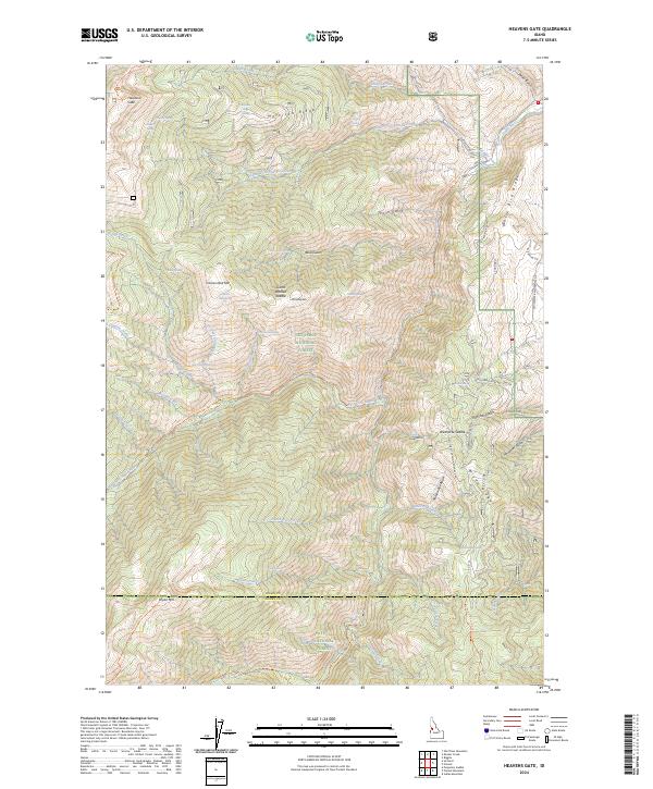
2024 Map of Heavens Gate
USGS Topo · Published 2024About this map
Hells Canyon Wilderness and the high ridges of the Nez-Perce National Forest dominate this landscape along the border of Idaho and Adams counties. The terrain is defined by dramatic elevation changes, from the depths of the Rapid River canyon to prominent summits like Cannon Ball Mtn and Mt Sampson. The Heavens Gate lookout area provides a central vantage point over the complex drainage systems of Shingle Creek and Cannon Creek.
Find a feature on this map
61 named features on this map. Tap any name to fly to it.
Don’t see what you’re looking for? This feature index may not catch every label — zoom into the map to look around manually.
Map Details
Editions of this 2024 Heavens Gate Map
This is the sole edition of this map. No revisions or reprints were ever made.
Other maps of this area

1920 · Seven Devils Mining District
USGS Topo · 1:48,000

1922 · He Devil
USGS Topo · 1:48,000

1938 · Riggins
USGS Topo · 1:96,000

1945 · Riggins
USGS Topo · 1:125,000

1955 · Grangeville
USGS Topo · 1:250,000

1957 · He Devil
USGS Topo · 1:62,500

1957 · Cuprum
USGS Topo · 1:62,500

1959 · Grangeville
USGS Topo · 1:250,000

1963 · Indian Mountain
USGS Topo · 1:24,000
1963 · Pollock Mountain
USGS Topo · 1:24,000