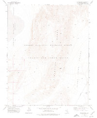
1973 Map of Heavens Well
USGS Topo · Published 1976About this map
Pintwater Range dominates the central topography of this 1970s survey, marking a stark vertical divide between the Three Lakes Valley to the east and the Indian Springs Depression Valley to the west. The landscape reflects the dual administrative nature of this Nevada desert, where the conservation efforts of the Desert National Wildlife Range overlap with the restricted military operations of the Nellis Air Force Range. Isolated water sources and man-made landmarks provide the few points of reference in this arid environment, most notably Heavens Well and a specialized Protective Dome BM 3052 located near the valley floor. Evidence of land use is sparse, limited to a Borrow Pit and a designated Target area, illustrating the region's primary function as a remote training and wildlife preservation corridor.
Find a feature on this map
12 named features on this map. Tap any name to fly to it.
Don’t see what you’re looking for? This feature index may not catch every label — zoom into the map to look around manually.
Map Details
Editions of this 1973 Heavens Well Map
2 editions found
Other maps of this area

1907 · Las Vegas
USGS Topo · 1:250,000

1908 · Las Vegas
USGS Topo · 1:250,000

1942 · Indian Spring
USGS Topo · 1:125,000

1945 · Sheep Range
USGS Topo · 1:125,000

1954 · Las Vegas
USGS Topo · 1:250,000

1957 · Las Vegas
USGS Topo · 1:250,000

1959 · Las Vegas
USGS Topo · 1:250,000

1962 · Las Vegas
USGS Topo · 1:250,000
1973 · Tim Spring
USGS Topo · 1:24,000
1973 · Dog Bone Lake South
USGS Topo · 1:24,000