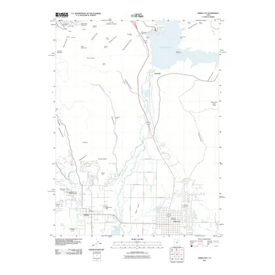
2011 Map of Heber City
USGS Topo · Published 2011About this map
The high mountain valley of Heber Valley is defined by a complex network of water management and legacy mining infrastructure. The northern reaches are dominated by the waters of Jordanelle Reservoir, where the Murdock Powerhouse and several tunnels, including the Keeler Tunnel and Cunningham Tunnel, indicate the intersection of utility and terrain. To the west, the mining history of the Wasatch Range is evident through numerous claims and subterranean features like the Glencoe Mine, Valeo Mine, and the Ontario Shaft Number 2 near Bald Mountain.
Find a feature on this map
88 named features on this map. Tap any name to fly to it.
Don’t see what you’re looking for? This feature index may not catch every label — zoom into the map to look around manually.
Map Details
Editions of this 2011 Heber City Map
This is the sole edition of this map. No revisions or reprints were ever made.
Other maps of this area

1885 · Salt Lake
USGS Topo · 1:250,000

1900 · Coalville
USGS Topo · 1:125,000

1903 · Coalville
USGS Topo · 1:125,000

1907 · Strawberry Valley
USGS Topo · 1:125,000

1909 · Strawberry Valley
USGS Topo · 1:125,000

1925 · Ft. Douglas
USGS Topo · 1:125,000

1928 · Ft. Douglas
USGS Topo · 1:125,000

1948 · Orem
USGS Topo · 1:62,500

1948 · Aspen Grove
USGS Topo · 1:24,000

1950 · Aspen Grove
USGS Topo · 1:24,000