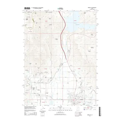
2014 Map of Heber City
USGS Topo · Published 2014About this map
Heber and Midway anchor this detailed study of the Heber Valley, situated where the Provo River flows between the high peaks of the Wasatch Range. The landscape is defined by an intricate network of irrigation and water management, including the Timpanogos Canal, Sagebrush and Spring Creek Canal, and Island Ditch, which support the valley floor below the Jordanelle Reservoir. High-elevation mining and engineering history is evident in the northwest corner near Park City, where the Ontario Drain Tunnel and Ontario Canyon point to the region's deep-rooted silver mining legacy.
Find a feature on this map
187 named features on this map. Tap any name to fly to it.
Don’t see what you’re looking for? This feature index may not catch every label — zoom into the map to look around manually.
Map Details
Editions of this 2014 Heber City Map
This is the sole edition of this map. No revisions or reprints were ever made.
Other maps of this area

1885 · Salt Lake
USGS Topo · 1:250,000

1900 · Coalville
USGS Topo · 1:125,000

1903 · Coalville
USGS Topo · 1:125,000

1907 · Strawberry Valley
USGS Topo · 1:125,000

1909 · Strawberry Valley
USGS Topo · 1:125,000

1925 · Ft. Douglas
USGS Topo · 1:125,000

1928 · Ft. Douglas
USGS Topo · 1:125,000

1948 · Orem
USGS Topo · 1:62,500

1948 · Aspen Grove
USGS Topo · 1:24,000

1950 · Aspen Grove
USGS Topo · 1:24,000