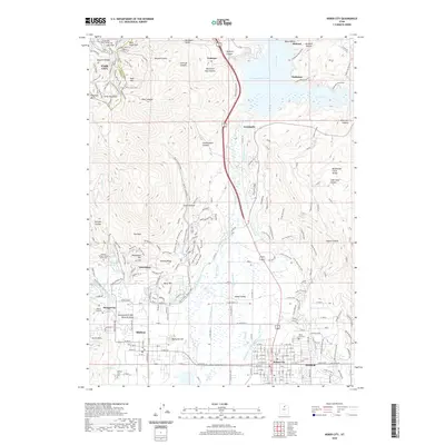
2020 Map of Heber City
USGS Topo · Published 2020About this map
Heber Valley serves as the central geographic feature of this 2020 map, where the valley floor is defined by an intricate network of irrigation and water management systems. The Provo River flows south into the valley, supported by the Timpanogos Canal, Wasatch Canal, and Westside Ditch. In the north, the substantial Jordanelle Reservoir dominates the terrain, bordered by the communities of Hideout and Hailstone. The western highlands are marked by the industrial history of Park City and the Ontario Canyon mining area, leading down toward the geological curiosity of the Homestead Crater Mineral Dome near Midway. Local heritage is well-preserved through numerous sites such as Memorial Hill, the William Walter Wilson Burial Site, and several burial grounds including Mound City Cem. This modern survey illustrates the balance between expanding residential areas like Interlaken and the legacy of the region's agricultural and mining foundations.
Find a feature on this map
63 named features on this map. Tap any name to fly to it.
Don’t see what you’re looking for? This feature index may not catch every label — zoom into the map to look around manually.
Map Details
Editions of this 2020 Heber City Map
This is the sole edition of this map. No revisions or reprints were ever made.
Other maps of this area

1885 · Salt Lake
USGS Topo · 1:250,000

1900 · Coalville
USGS Topo · 1:125,000

1903 · Coalville
USGS Topo · 1:125,000

1907 · Strawberry Valley
USGS Topo · 1:125,000

1909 · Strawberry Valley
USGS Topo · 1:125,000

1925 · Ft. Douglas
USGS Topo · 1:125,000

1928 · Ft. Douglas
USGS Topo · 1:125,000

1948 · Orem
USGS Topo · 1:62,500

1948 · Aspen Grove
USGS Topo · 1:24,000

1950 · Aspen Grove
USGS Topo · 1:24,000