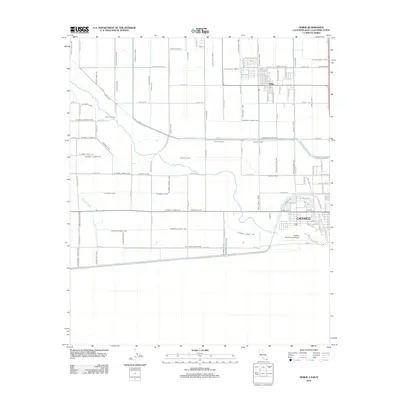
2012 Map of Heber
USGS Topo · Published 2012About this map
Calexico and Heber anchor this 2012 study of the Imperial Valley's intricate water management infrastructure along the international border. The landscape is defined by an exhaustive grid of irrigation works, including the Central Main Canal, Elder Canal, and Wistara Canal, which sustain the region's intensive agriculture. These waterways, alongside smaller features like the Dahua Lateral and Eucalyptus Canal, reveal how the desert has been engineered into a productive valley.
Find a feature on this map
122 named features on this map. Tap any name to fly to it.
Don’t see what you’re looking for? This feature index may not catch every label — zoom into the map to look around manually.
Map Details
Editions of this 2012 Heber Map
This is the sole edition of this map. No revisions or reprints were ever made.
Other maps of this area

1907 · Holtville
USGS Topo · 1:125,000

1915 · El Centro
USGS Topo · 1:125,000

1940 · Brawley
USGS Topo · 1:62,500

1940 · Heber
USGS Topo · 1:62,500

1940 · Alamorio
USGS Topo · 1:62,500

1940 · Calexico
USGS Topo · 1:62,500

1942 · El Centro
USGS Topo · 1:250,000

1943 · Heber
USGS Topo · 1:62,500

1943 · Brawley
USGS Topo · 1:62,500

1943 · Calexico
USGS Topo · 1:62,500