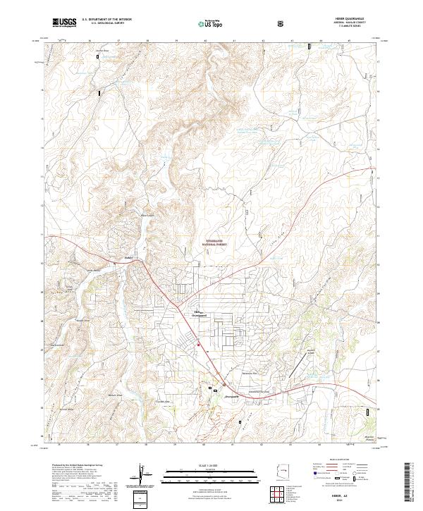
2021 Map of Heber
USGS Topo · Published 2021About this map
Heber-Overgaard sits at the heart of this Navajo County landscape, where the high country of the Mogollon Plateau meets the dense woodlands of the Sitgreaves National Forest. The map documents a community deeply integrated with its natural environment, showing the residential expansion of Heber and Overgaard alongside specialized developments like the Mogollon Airpark. This modern survey reveals a complex network of forest trails and water management features, such as Pasture Trl and Section Thirty-three Number Two Tank, essential for sustaining life and recreation in this arid upland.
Find a feature on this map
53 named features on this map. Tap any name to fly to it.
Don’t see what you’re looking for? This feature index may not catch every label — zoom into the map to look around manually.
Map Details
Editions of this 2021 Heber Map
This is the sole edition of this map. No revisions or reprints were ever made.
Other maps of this area

1886 · Holbrook
USGS Topo · 1:250,000

1893 · Holbrook
USGS Topo · 1:250,000

1954 · Holbrook
USGS Topo · 1:250,000

1957 · Holbrook
USGS Topo · 1:250,000

1958 · Holbrook
USGS Topo · 1:250,000

1960 · Holbrook
USGS Topo · 1:250,000

1961 · Clay Springs
USGS Topo · 1:62,500

1961 · Heber
USGS Topo · 1:62,500

1970 · Red Knoll
USGS Topo · 1:24,000
1971 · Zeniff
USGS Topo · 1:24,000