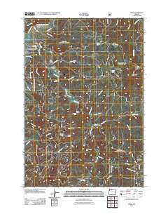
2011 Map of Hebo
USGS Topo · Published 2011About this map
Hebo and the surrounding coastal range highlands of Tillamook County are defined here by a dense network of forest service roads and water management facilities. The map captures the specialized infrastructure of the region, featuring the Cedar Creek Hatchery and Rhodes Rearing Pond along the banks of Three Rivers. Genealogy researchers will find the Independent Order of Odd Fellows Hebo Cemetery and Gist Cemetery located among the rising elevations of Gauldy Ridge and Mount Gauldy. The landscape is etched with countless drainages, including Cedar Creek and Pollard Creek, which flow toward the Nestucca River. Key landmarks such as the Hebo Post Office, Hebo Work Camp, and Castlerock Lodge illustrate the mix of federal land management, local residence, and outdoor recreation in this corner of the Siuslaw National Forest. High-elevation points like Mount Hebo and South Point overlook the transition from settlement to timbered slopes.
Find a feature on this map
51 named features on this map. Tap any name to fly to it.
Don’t see what you’re looking for? This feature index may not catch every label — zoom into the map to look around manually.
Map Details
Editions of this 2011 Hebo Map
This is the sole edition of this map. No revisions or reprints were ever made.
Other maps of this area

1941 · Nestucca Bay
USGS Topo · 1:62,500

1942 · Ginger Peak
USGS Topo · 1:62,500

1942 · Spirit Mtn
USGS Topo · 1:62,500

1942 · Nestucca Bay
USGS Topo · 1:62,500

1942 · Tillamook
USGS Topo · 1:62,500

1948 · Vancouver
USGS Topo · 1:250,000

1950 · Vancouver
USGS Topo · 1:250,000

1950 · Vancouver
USGS Topo · 1:250,000

1955 · Hebo
USGS Topo · 1:62,500

1955 · Blaine
USGS Topo · 1:62,500