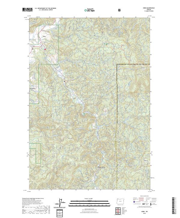
2023 Map of Hebo
USGS Topo · Published 2023About this map
Hebo and Cloverdale anchor the northwestern portion of this 2023 survey, where the Nestucca River meets Three Rivers along the Oregon Coast Highway. The landscape is dominated by the steep rises of the Siuslaw National Forest, containing high points like Mt Hebo and Mt Gauldy. Local history and genealogy are well-preserved through the inclusion of the Nestucca Valley Community Cem and the Gist Cem near Dorothy Creek. Significant for those tracking historic transit routes, the map labels the Pioneer Indian Trl winding through the hills near Hebo Lake. This recent data reflects the modern boundaries between Tillamook and Yamhill counties, tracing a complex network of forest development roads that connect isolated points like Happy Hollow to the coastal corridor.
Find a feature on this map
45 named features on this map. Tap any name to fly to it.
Don’t see what you’re looking for? This feature index may not catch every label — zoom into the map to look around manually.
Map Details
Editions of this 2023 Hebo Map
This is the sole edition of this map. No revisions or reprints were ever made.
Other maps of this area

1941 · Nestucca Bay
USGS Topo · 1:62,500

1942 · Ginger Peak
USGS Topo · 1:62,500

1942 · Spirit Mtn
USGS Topo · 1:62,500

1942 · Nestucca Bay
USGS Topo · 1:62,500

1942 · Tillamook
USGS Topo · 1:62,500

1948 · Vancouver
USGS Topo · 1:250,000

1950 · Vancouver
USGS Topo · 1:250,000

1950 · Vancouver
USGS Topo · 1:250,000

1955 · Hebo
USGS Topo · 1:62,500

1955 · Blaine
USGS Topo · 1:62,500