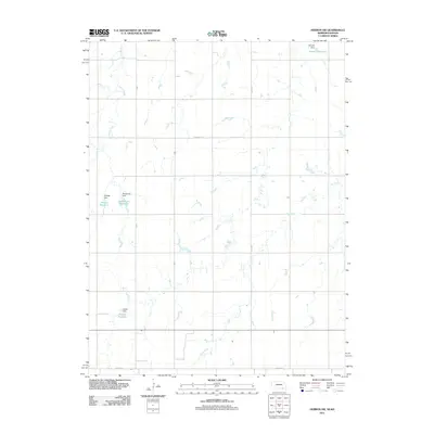
2011 Map of Hebron SW
USGS Topo · Published 2011About this map
Agricultural water management and family-named infrastructure define this portion of Thayer County, Nebraska, near the Kansas border. This rural landscape is heavily shaped by the drainage of Spring Creek in the northwest and the meandering course of Dry Creek through the central and eastern sections. A notable concentration of small-scale reservoirs indicates a history of localized water control for ranching or irrigation, with several sites bearing family names such as Dittmer Reservoir, Bostelman Reservoir, Koester Reservoir, and Harms Reservoir. Each of these is supported by its corresponding earthen structure, including Dittmer Dam and Harms Dam. The road network is primarily composed of section-line roads, with Stoddard Rd and Co Road A providing the primary east-west transit through this prairie terrain. The absence of major urban centers highlights the area's enduring character as a sparsely populated farming district.
Find a feature on this map
14 named features on this map. Tap any name to fly to it.
Don’t see what you’re looking for? This feature index may not catch every label — zoom into the map to look around manually.
Map Details
Editions of this 2011 Hebron SW Map
This is the sole edition of this map. No revisions or reprints were ever made.
Other maps of this area

1892 · Concordia
USGS Topo · 1:125,000

1898 · Hebron
USGS Topo · 1:125,000

1955 · Manhattan
USGS Topo · 1:250,000

1955 · Lincoln
USGS Topo · 1:250,000

1956 · Manhattan
USGS Topo · 1:250,000

1957 · Manhattan
USGS Topo · 1:250,000

1957 · Lincoln
USGS Topo · 1:250,000

1958 · Lincoln
USGS Topo · 1:250,000

1960 · Byron
USGS Topo · 1:24,000

1960 · Chester
USGS Topo · 1:24,000