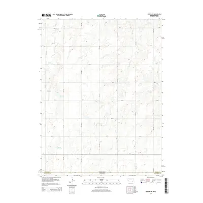
2014 Map of Hebron SW
USGS Topo · Published 2014About this map
The state line between Nebraska and Kansas bisects the southern reaches of this landscape, marking the transition between Thayer County and Republic County. The terrain is defined by a grid-like network of rural transit, featuring numbered corridors such as Road 5500 and Road 5600, alongside established routes like Ne-8 and Ash Rd. Water management is a primary characteristic of this agricultural region, evidenced by several private impoundments including Koester Reservoir, Bostelman Reservoir, and Harms Reservoir. These features, along with Pittmer Reservoir in the northeast, underscore the reliance on captured surface water to support the local plains economy. Natural drainage is provided by the winding courses of Spring Cr and Dry Cr, which carve subtle valleys through the surveyed sections.
Find a feature on this map
24 named features on this map. Tap any name to fly to it.
Don’t see what you’re looking for? This feature index may not catch every label — zoom into the map to look around manually.
Map Details
Editions of this 2014 Hebron SW Map
This is the sole edition of this map. No revisions or reprints were ever made.
Other maps of this area

1892 · Concordia
USGS Topo · 1:125,000

1898 · Hebron
USGS Topo · 1:125,000

1955 · Manhattan
USGS Topo · 1:250,000

1955 · Lincoln
USGS Topo · 1:250,000

1956 · Manhattan
USGS Topo · 1:250,000

1957 · Manhattan
USGS Topo · 1:250,000

1957 · Lincoln
USGS Topo · 1:250,000

1958 · Lincoln
USGS Topo · 1:250,000

1960 · Byron
USGS Topo · 1:24,000

1960 · Chester
USGS Topo · 1:24,000