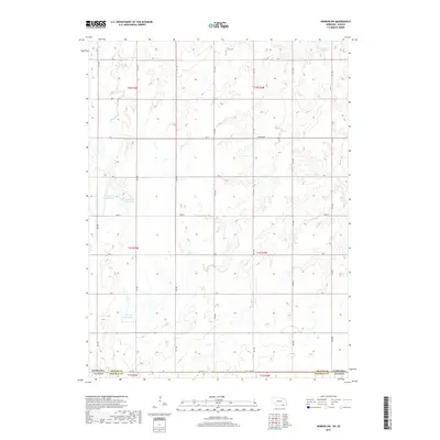
2017 Map of Hebron SW
USGS Topo · Published 2017About this map
State Line Rd defines the southern boundary of this section of the Great Plains, marking the border between Thayer County, Nebraska and Republic County, Kansas. The landscape is primarily shaped by an intricate network of drainages, including the headwaters of Spring Cr and Dry Cr, which carve through the high prairie. Water management is a central feature of the local geography, evidenced by several family-named impoundments such as Dittmer Reservoir, Harms Reservoir, and the adjacent Koester Reservoir and Bostelman Reservoir. These reservoirs reflect the agricultural necessity of water storage in a region dominated by section-line roads like Stoddard Rd and Ash. The map provides a clear view of the rural land divisions and township boundaries, including t1n r3w and t2n r4w, which have dictated the settlement patterns of this borderland area for over a century.
Find a feature on this map
27 named features on this map. Tap any name to fly to it.
Don’t see what you’re looking for? This feature index may not catch every label — zoom into the map to look around manually.
Map Details
Editions of this 2017 Hebron SW Map
This is the sole edition of this map. No revisions or reprints were ever made.
Other maps of this area

1892 · Concordia
USGS Topo · 1:125,000

1898 · Hebron
USGS Topo · 1:125,000

1955 · Manhattan
USGS Topo · 1:250,000

1955 · Lincoln
USGS Topo · 1:250,000

1956 · Manhattan
USGS Topo · 1:250,000

1957 · Manhattan
USGS Topo · 1:250,000

1957 · Lincoln
USGS Topo · 1:250,000

1958 · Lincoln
USGS Topo · 1:250,000

1960 · Byron
USGS Topo · 1:24,000

1960 · Chester
USGS Topo · 1:24,000