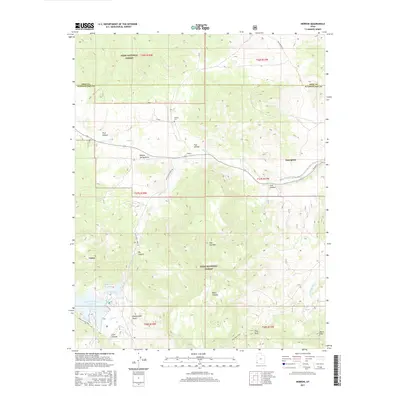
2017 Map of Hebron
USGS Topo · Published 2017About this map
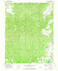
Hebron and Enterprise anchor this high-desert landscape in southwestern Utah, where the headwaters of Shoal Cr carve through complex geological formations. The map details the historical footprint of Hebron, once a primary settlement, now marked by the Hebron Cem along the creek. To the east, the town of Enterprise stands as the modern hub of the valley, connected by Veyo Shoal Creek Rd. High-elevation topography is dominated by the Dixie National Forest, which covers much of the southern and northern reaches, featuring notable landmarks like Pilot Peak and the distinctive Honeycomb Rocks. Water management is central to the area's geography, evidenced by the Upper Enterprise Reservoir and Lower Enterprise Reservoir situated in the western canyons. These reservoirs, along with numerous drainages like Big Canyon and Black Canyon, illustrate the critical relationship between the high forest watersheds and the agricultural settlements in the valley below.
Find a feature on this map
40 named features on this map. Tap any name to fly to it.
Don’t see what you’re looking for? This feature index may not catch every label — zoom into the map to look around manually.
Map Details
Editions of this 2017 Hebron Map
This is the sole edition of this map. No revisions or reprints were ever made.
Other maps of this area

1885 · St. George
USGS Topo · 1:250,000

1891 · St. George
USGS Topo · 1:250,000

1953 · Cedar City
USGS Topo · 1:250,000

1958 · Cedar City
USGS Topo · 1:250,000

1962 · Cedar City
USGS Topo · 1:250,000

1972 · Pinon Point
USGS Topo · 1:24,000
1972 · Beryl Junction
USGS Topo · 1:24,000
1972 · Mount Escalante
USGS Topo · 1:24,000
1972 · Goldstrike
USGS Topo · 1:24,000
1972 · Central West
USGS Topo · 1:24,000