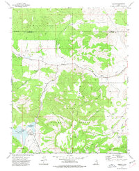
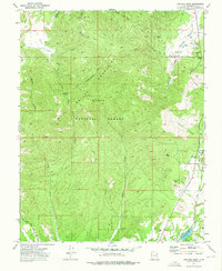
1972 Map of Hebron
USGS Topo · Published 1977About this map
Hebron sits along the upper reaches of Shoal Creek in a landscape where high desert elevations meet the managed resources of the Dixie National Forest. This 1970s survey captures the area just south of the Iron and Washington County line, documenting the transition from the old settlement at Hebron to the recreation-focused infrastructure at the Lower Enterprise Reservoir and Upper Enterprise Reservoir. The presence of the Hebron Cem provides a primary point of reference for genealogists tracking early families in this corner of southwestern Utah.
Find a feature on this map
26 named features on this map. Tap any name to fly to it.
Don’t see what you’re looking for? This feature index may not catch every label — zoom into the map to look around manually.
Map Details
Editions of this 1972 Hebron Map
This is the sole edition of this map. No revisions or reprints were ever made.
Other maps of this area

1885 · St. George
USGS Topo · 1:250,000

1891 · St. George
USGS Topo · 1:250,000

1953 · Cedar City
USGS Topo · 1:250,000

1958 · Cedar City
USGS Topo · 1:250,000

1962 · Cedar City
USGS Topo · 1:250,000

1972 · Pinon Point
USGS Topo · 1:24,000
1972 · Beryl Junction
USGS Topo · 1:24,000
1972 · Mount Escalante
USGS Topo · 1:24,000
1972 · Goldstrike
USGS Topo · 1:24,000
1972 · Central West
USGS Topo · 1:24,000