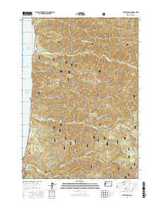
2017 Map of Heceta Head
USGS Topo · Published 2017About this map
Searose Beach sits along the Pacific edge of a landscape defined by the dense drainages of the Siuslaw National Forest and the protected shoreline of the Oregon Islands National Wildlife Refuge. The map provides a detailed view of the coastal interface where steep ridges like Cummins Ridge and Blue Ridge meet the sea. Local history is anchored by the Stonefield Beach Burials located just south of Bray Point, a significant site of heritage along the coastal highway. The southern end of the sheet is dominated by the prominent landmark of Heceta Head, featuring the Cape Creek Tunnel 3961 as a critical infrastructure point. Numerous coastal streams, including Tenmile Creek and Big Creek, carve deep valleys through the timbered heights of Fairview Mountain, illustrating the difficult terrain that shaped early regional transport and land use patterns.
Find a feature on this map
40 named features on this map. Tap any name to fly to it.
Don’t see what you’re looking for? This feature index may not catch every label — zoom into the map to look around manually.
Map Details
Editions of this 2017 Heceta Head Map
This is the sole edition of this map. No revisions or reprints were ever made.
Other maps of this area

1918 · Mapleton
USGS Topo · 1:48,000

1920 · Heceta Head
USGS Topo · 1:62,500

1922 · Waldport
USGS Topo · 1:62,500

1940 · Mapleton
USGS Topo · 1:62,500

1942 · Waldport
USGS Topo · 1:62,500

1942 · Heceta Head
USGS Topo · 1:62,500

1942 · Tidewater
USGS Topo · 1:62,500

1945 · Mapleton
USGS Topo · 1:62,500

1953 · Salem
USGS Topo · 1:250,000

1954 · Salem
USGS Topo · 1:250,000