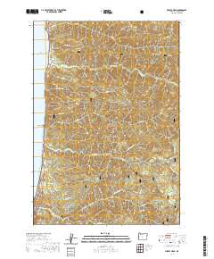
2020 Map of Heceta Head
USGS Topo · Published 2020About this map
Searose Beach sits along the Pacific shoreline on this 2020 topographic map, marking a small pocket of coastal habitation between the Siuslaw National Forest and the ocean. The Oregon Coast Highway provides the primary artery for the region, threading through a landscape defined by significant elevation changes from sea level to peaks like Fairview Mtn. Notable for local history, the Stonefield Beach Burials are located just south of Agate Cr, offering a glimpse into the human presence along this stretch of the coast.
Find a feature on this map
35 named features on this map. Tap any name to fly to it.
Don’t see what you’re looking for? This feature index may not catch every label — zoom into the map to look around manually.
Map Details
Editions of this 2020 Heceta Head Map
This is the sole edition of this map. No revisions or reprints were ever made.
Other maps of this area

1918 · Mapleton
USGS Topo · 1:48,000

1920 · Heceta Head
USGS Topo · 1:62,500

1922 · Waldport
USGS Topo · 1:62,500

1940 · Mapleton
USGS Topo · 1:62,500

1942 · Waldport
USGS Topo · 1:62,500

1942 · Heceta Head
USGS Topo · 1:62,500

1942 · Tidewater
USGS Topo · 1:62,500

1945 · Mapleton
USGS Topo · 1:62,500

1953 · Salem
USGS Topo · 1:250,000

1954 · Salem
USGS Topo · 1:250,000