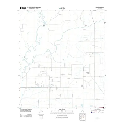
2012 Map of Hecker
USGS Topo · Published 2012About this map
The Calcasieu River and its meandering tributaries, including Bayou Serpent and Bayou Arceneaux, define the landscape of this Calcasieu Parish region. Near the small settlement of Hecker, the terrain features several oxbows and islands like Stackpole Island and Point Fing. The era's industrial and agricultural footprint is evident through the massive Louisiana Irrigation Canal and Jones Canal, which cut straight lines across the native drainage patterns. Further south, the Iowa Oil and Gas Field indicates the sub-surface resources that shaped the local economy. Genealogists can trace local family lineages through roads like Charles Breaux Rd and Lebleu Ln, alongside burial sites such as Herbert Cem and La France Cem. The settlement of Le Bleu serves as a local hub near the southern boundary, surrounded by a dense grid of residential and parish roads.
Find a feature on this map
83 named features on this map. Tap any name to fly to it.
Don’t see what you’re looking for? This feature index may not catch every label — zoom into the map to look around manually.
Map Details
Editions of this 2012 Hecker Map
This is the sole edition of this map. No revisions or reprints were ever made.
Other maps of this area

1932 · Lake Charles NE
USGS Topo · 1:31,680

1932 · Lake Charles NW
USGS Topo · 1:31,680

1935 · Moss Bluff
USGS Topo · 1:31,680

1935 · Gaytine
USGS Topo · 1:31,680

1942 · Lake Charles
USGS Topo · 1:62,500

1946 · Lacassine
USGS Topo · 1:31,680

1947 · Gaytine
USGS Topo · 1:31,680

1947 · Fenton
USGS Topo · 1:31,680

1947 · Moss Bluff
USGS Topo · 1:31,680

1947 · Hecker
USGS Topo · 1:31,680