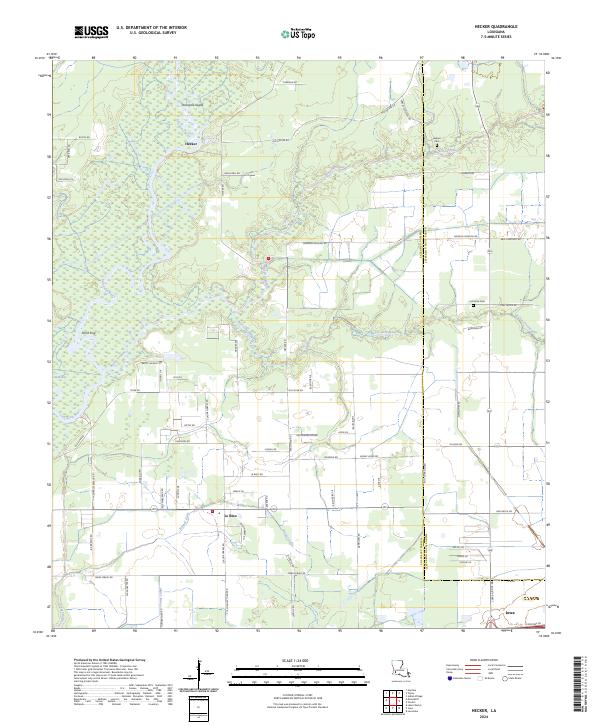
2024 Map of Hecker
USGS Topo · Published 2024About this map
The Calcasieu River winds through the western reaches of this landscape, defining a network of wetlands and tributaries such as Bayou Serpent and Bayou Arceneaux. This area of Calcasieu Parish is characterized by rural settlements like Hecker and Le Bleu, where the land use reflects a transition between the drainage basins and the open plains near Iowa. In the north, Stackpole Island sits within the river’s reach, while family-named landmarks and local burial grounds, including Herbert Cem and La France Cem, provide clear indicators of the long-standing community footprint in the region.
Find a feature on this map
75 named features on this map. Tap any name to fly to it.
Don’t see what you’re looking for? This feature index may not catch every label — zoom into the map to look around manually.
Map Details
Editions of this 2024 Hecker Map
This is the sole edition of this map. No revisions or reprints were ever made.
Other maps of this area

1932 · Lake Charles NE
USGS Topo · 1:31,680

1932 · Lake Charles NW
USGS Topo · 1:31,680

1935 · Moss Bluff
USGS Topo · 1:31,680

1935 · Gaytine
USGS Topo · 1:31,680

1942 · Lake Charles
USGS Topo · 1:62,500

1946 · Lacassine
USGS Topo · 1:31,680

1947 · Gaytine
USGS Topo · 1:31,680

1947 · Fenton
USGS Topo · 1:31,680

1947 · Moss Bluff
USGS Topo · 1:31,680

1947 · Hecker
USGS Topo · 1:31,680