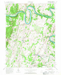
1955 Map of Hedgesville
USGS Topo · Published 1967About this map
Potomac River bends dramatically through the The Neck and Millers Bend, anchoring a landscape defined by 19th-century transit corridors and Civil War legacy. This 1955 revision documents the enduring infrastructure of the Chesapeake and Ohio Canal, with numerous locks including Lock No 43 and Lock No 48 clearly marked alongside the Baltimore and Ohio Railroad. The map captures the heart of the eastern panhandle at Hedgesville, extending east to the Stonewall Jackson Monument near Falling Waters. Industrial and agricultural patterns are evident in the presence of the Cumbo Yard rail facility and various water sources like Harland Spring and Spring Mills. Small communities such as Little Georgetown, Allensville, and Bedington dot the terrain between North Mountain and the river, offering a detailed view of Berkeley County's mid-century rural character.
Find a feature on this map
58 named features on this map. Tap any name to fly to it.
Don’t see what you’re looking for? This feature index may not catch every label — zoom into the map to look around manually.
Map Details
Editions of this 1955 Hedgesville Map
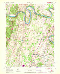
2 editions found
Other maps of this area

1884 · Harpers Ferry
USGS Topo · 1:125,000

1891 · Harpers Ferry
USGS Topo · 1:125,000

1893 · Harpers Ferry
USGS Topo · 1:125,000

1894 · Winchester
USGS Topo · 1:125,000

1899 · Hancock
USGS Topo · 1:62,500

1901 · Hancock
USGS Topo · 1:62,500

1912 · Williamsport
USGS Topo · 1:62,500

1914 · Martinsburg
USGS Topo · 1:48,000

1914 · Gerrardstown
USGS Topo · 1:48,000

1916 · Gerrardstown
USGS Topo · 1:62,500